| While the multilateration concept was originally developed for military air surveillance purposes, one of its earliest civil aviation applications was in the monitoring of aircraft movements on the airport’s surface. Today, multilateration is a vital element of Advanced Surface Movement Guidance and Control Systems (A-SMGCS), which are currently being deployed at many of the world’s major airports. Prior to the introduction of multilateration, airport surface surveillance was performed by radar — called either Airport Surface Detection Equipment (ASDE) or Surface Movement Radar (SMR) — with its rapidly rotating antenna typically mounted above the control tower for optimum view of the airport surface. However, it was quickly realized that the radar’s line of sight was blocked by the large airport terminal buildings, hangars and other obstacles, preventing its view of many critical movement areas. Heavy rain was also found to severely affect SMR performance.
The addition of strategically positioned multilateration stations provides ground controllers with a clear view of every “hidden” area of the airport surface, with greatly enhanced accuracy and improved target discrimination, regardless of the weather conditions. Unlike SMR, multilateration also provides unique identification of all aircraft — and not just a “blob” — and stops tags from jumping from one target to another as they would get near each other. Another benefit is that small squitter devices, with unique identification codes, can be mounted on surface vehicles and fully integrated into the A-SMGCS. Multilateration-supported A-SMGCS installations are in very wide use at major airports around the world, and have made a major contribution to the reduction in runway incursion incidents. | | Advanced Surface Movement Guidance and Control Systems
(A-SMGCS) Copenhagen Airport’s A-SMGCS fuses highly accurate position and identification data from MLAT ground stations and vehicle tracking units with SMR data. 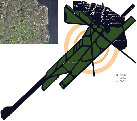
A-SMGCS platforms utilizing multilateration have become the industry standard at the world’s busiest airports to reduce the increasing risk of runway incursions as operations grow and surface congestion increases. MLAT expands coverage areas, identifies aircraft, tracks vehicles and maintains performance in all weather conditions. |